Mapping & surveying
See what the fence line hides
Whole-farm maps, crop-health indices and elevation models - flown in an afternoon, processed on your desk, accurate enough to act on.
Request a quoteWritten quote within one business day.
- Australian owned & operated
- Delivery, training & CASA guidance included
- Quotes within one business day

The jobs
What it does on your place
Walk to the right spot, not the whole paddock
Crop-health indices show variation you can't pick from the fence line. Fly the paddock, find the patch that's struggling, and go ground-truth that spot instead of guessing.
Map your levels before you move dirt
Elevation models show where water sits, where it runs and where it won't. Plan drainage, contour banks and laser-bucket work off real numbers.
A farm map that's actually current
High-resolution orthomosaics of the whole place — fences, tracks, tanks, timber — flown this season, not traced off imagery from three years ago.
Scout it, prescribe it, apply it
The map isn't the end point. Build a variable-rate prescription from the scout and an Agras applies straight to it — more product where it's needed, less where it isn't.
Straight talk
Which drone actually does NDVI
Ag-tech marketing blurs this line constantly, so here it is straight. A crop-health index like NDVI needs dedicated multispectral sensors — a sharp RGB camera can't produce one, no matter what the brochure implies.
Mavic 3M — real multispectral
Dedicated green, red, red-edge and near-infrared bands alongside the RGB camera. It produces genuine NDVI and NDRE — the indices your agronomist can actually work with. If crop health is the job, this is the aircraft.
Matrice 4E — sharp, but visible-light
An excellent RGB mapping aircraft — crisp orthomosaics, elevation models, measurement work. But it has no multispectral bands, so it cannot produce NDVI or any crop-health index. If someone tells you otherwise, they're selling you the wrong drone.

How a map gets made
Mark the boundary, set the overlap, and the aircraft flies its grid on its own — hundreds of overlapping photos in a single flight. Processing software stitches them into one measurable map: an orthomosaic, an elevation model, or a health index.

When you need LiDAR instead of a camera
A camera measures the treetops and guesses at the ground. LiDAR fires laser pulses through the gaps in the canopy and gets returns off the actual dirt - which is the entire reason to buy it. Bare paddocks don't need it. Timbered country, creek lines and anything under vegetation do.
The sensors
What's doing the measuring
Mavic 3M
Zenmuse L2 on Matrice 400
Figures are DJI's published specifications. Achievable map accuracy depends on RTK positioning, ground control and flight setup — we'll tell you what your configuration can and can't be trusted for. Confirm current figures against DJI's spec sheet.
The honest bits
What we'll tell you before you buy
Mapping gear gets oversold. Here's where the real limits sit — so the kit you buy matches the job you actually have.
A LiDAR kit alone isn't a working system
The L2 needs RTK positioning and processing software — DJI Terra or equivalent — before it produces anything you can use. Neither is in the base kit, so we quote all three together. A LiDAR quote without them isn't cheaper, it's incomplete.
Accuracy claims need RTK behind them
Centimetre-level maps need RTK positioning and proper setup. Without it, expect metre-level — fine for scouting, not for earthworks or boundaries. We'll tell you plainly what your configuration can be trusted for.
CASA still applies to mapping flights
Mapping is still drone operation — accreditation or a licence applies depending on aircraft weight and the nature of the work. We walk you through what applies before you buy.
Processing is part of the job
The flight is the quick bit. Turning photos into maps takes processing software and a computer that can run it. We set you up, train you on the workflow, and stay on the phone for the first few paddocks.
The rules move. Confirm the current CASA position with a compliance advisor before you fly. And if a Mavic 3M covers your program, that's what we'll quote you — LiDAR is for jobs that genuinely need ground returns through canopy, not a default upsell.
The gear
The kits that do the job
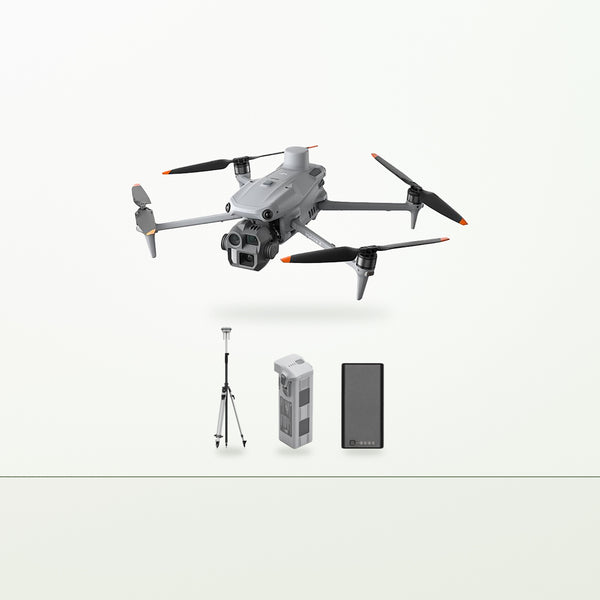
DJI Matrice 4E Vegetation Mapping Kit
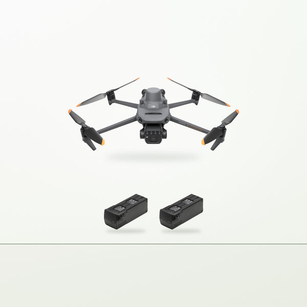
DJI Mavic 3M Crop Scouting Kit

DJI Dock 3 + Matrice 4D Farm Monitoring Kit
Every kit includes delivery, commissioning, flight testing, hands-on operator training, CASA guidance, ongoing phone support and local servicing. These are quote-based — request a quote and we'll come back within one business day.
Straight answers
Asked every week
What's the difference between NDVI and a normal photo?
Can the Matrice 4E do crop-health maps?
Why do you quote the LiDAR kit with RTK and software?
How accurate are the maps?
Do I need a licence for mapping flights?
Tell us what you need to see
Crop health, drainage, whole-farm planning or survey work — describe the job and we'll spec the right sensor for it, and tell you plainly if a cheaper one covers it. Quotes within one business day.
Request a quoteWritten quote within one business day.