LiDAR vs photogrammetry: when a camera drone isn't enough
A camera measures the treetops and guesses at the ground. LiDAR sees through the canopy to the dirt. Here's when that difference is worth the price of a Matrice 400 with a Zenmuse L2, when it isn't, and the two things a LiDAR kit needs before it's a working system.

Short version
- Photogrammetry stitches photos into a 3D model. It's cheap, accurate on open ground, and blind under vegetation, because a camera can't see what the leaves cover.
- LiDAR fires laser pulses and records multiple returns per pulse, so it can hit the ground between leaves. That canopy penetration is the entire reason to buy it.
- A LiDAR payload on its own isn't a working system. It needs RTK positioning and processing software (DJI Terra or equivalent). We quote all three together, always.
If you're mapping bare paddocks, dams, stockpiles or infrastructure, a good camera drone is the right tool and we'll sell you one. If you need the ground under trees, scrub, standing crop or regrowth, you need LiDAR, and no amount of clever software changes that. This guide explains the difference plainly, so you buy the right one.
How each one works
Photogrammetry flies a grid of overlapping photos and uses software to find the same points in many images and triangulate them in 3D. The output is a dense point cloud, an orthomosaic and a digital surface model. On open ground with RTK positioning, a Matrice 4E or Mavic 3M produces survey-grade results for a fraction of the cost of LiDAR.
LiDAR fires laser pulses at the ground and times the returns. The Zenmuse L2 records up to five returns per pulse, at up to 240,000 points per second single-return or 1.2 million points per second with multiple returns, with a detection range DJI quotes at 450 m at 50 per cent reflectivity. Where a pulse hits a leaf, part of the energy carries on and some of it reaches the ground. Classify the returns and you have a bare-earth model under the canopy.
The one thing that decides it: can you see the ground?
The honest bit
Photogrammetry measures the top of whatever's there. Over a treed gully it gives you a beautiful, accurate model of the treetops and an interpolated guess at the ground underneath. That guess can be metres out. If the ground under vegetation is the thing you need (drainage, earthworks, cut and fill, flood modelling, carbon project baselines, erosion), LiDAR is the tool. If it isn't, LiDAR is an expensive way to do what a camera does.
That's the whole decision. Everything else (speed, colour, cost) is secondary.
Who buys LiDAR
Environmental and carbon project developers. Baseline and repeat measurements of vegetation structure and terrain under canopy, dated and geo-referenced.
Councils and consultants. Drainage, road corridors, flood studies and earthworks through timbered country.
Agriculture with a terrain problem. Contour and drainage design across paddocks where trees and crop block a camera, or large earthworks where cut-and-fill volumes matter.
Forestry and revegetation. Canopy height, structure and ground under it, from one flight.
If you're a grower who wants a paddock map and a crop-health index, this isn't your aircraft; the Mavic 3M is, and here's why.
What the Zenmuse L2 delivers
DJI quotes the L2's post-processed accuracy at 5 cm horizontal and 4 cm vertical at 150 m flying height, with the RGB camera (4/3 CMOS, 20 MP) colourising the point cloud so you get a true-colour 3D model as well as the laser data. It's carried on the Matrice 400 (and the Matrice 350 RTK and 300 RTK), and the point cloud exports in LAS, PLY, PCD, PNTS and S3MB for whatever GIS or CAD package you use.
Those are manufacturer figures under controlled conditions. Your results depend on flight height, overlap, GNSS conditions and ground control. We'll help you set the mission up to get close to them.
Why a LiDAR kit is three things, not one
This is where people get caught. A Matrice 400 with an L2 on the front is not a working survey system until you add:
- RTK positioning. LiDAR is only as good as the aircraft's position and orientation. You need an RTK correction source: a D-RTK base station, a network RTK subscription, or post-processed kinematic (PPK) workflow. Without it, the point cloud is precise but not accurate.
- Processing software. The raw data has to be processed into a classified point cloud and a bare-earth model. DJI Terra does this natively for the L2; other packages can too. It's a licence, and it's not in the base kit.
- The aircraft and payload. The Matrice 400 with the L2.
We quote all three together because a LiDAR kit that arrives without the first two is a very expensive paperweight, and we'd rather have the conversation before you buy than after.
The licensing side
The Matrice 400 is well over the 2 kg landholder threshold, so on your own land you're into the 2 to 25 kg landholder category (accreditation, registration, standard operating conditions) or, more likely for consultants and councils flying on client sites, a RePL and a ReOC. Most LiDAR buyers are already ReOC holders. If you're not, we'll walk through what it involves before you commit, and we'll tell you to confirm the current position with CASA or a compliance advisor.
The honest case for photogrammetry
For most farm mapping, a Matrice 4E with RTK is the better buy: a fraction of the price, faster to fly, and accurate on open ground. Stockpile volumes, dam surveys, fence and infrastructure mapping, irrigation layout on bare paddocks, and general orthomosaics are all photogrammetry jobs. Buy LiDAR for the ground you can't see. Buy a camera for the ground you can.
Common questions
Can LiDAR see through trees?
It sees between the leaves. Where pulses find gaps in the canopy, some returns reach the ground, and classification software separates ground from vegetation. Dense canopy reduces ground returns but rarely eliminates them.
Is drone LiDAR accurate enough for survey work?
DJI quotes 5 cm horizontal and 4 cm vertical for the L2 at 150 m after processing, with RTK. Whether that meets your survey standard depends on the job, ground control and your processing. Talk to your surveyor about what they'll accept.
What software do I need for the Zenmuse L2?
DJI Terra processes L2 data natively into classified point clouds and terrain models. Other LiDAR packages can process the exported data. A licence is required and it's not in the base kit; we quote it alongside.
Do I need RTK for LiDAR?
Yes. Without accurate positioning the point cloud is internally precise but not accurate in the real world. RTK or PPK is part of every LiDAR kit we quote.
Sources
- DJI Zenmuse L2 specifications, enterprise.dji.com/zenmuse-l2/specs
- DJI Matrice 4 Series and Mavic 3M specifications, enterprise.dji.com
- CASA, drone weight categories and requirements, casa.gov.au
- Rural Robotics kit pricing, current at time of writing; confirm on quote
Written quote within one business day. Delivery, training and CASA guidance included.

What a DJI Agras spray drone actually costs in Australia in 2026, what a working kit includes, and the lice...
Read
A spray drone is a $40,000-plus decision. Here's how to work out whether it beats the boom, beats the contr...
Read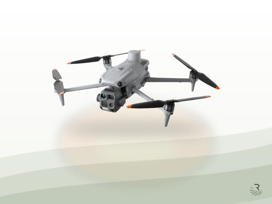
A thermal drone finds warm bodies in cold country and spots a leaking trough from the air. It also goes bli...
Read